12 jours
Ref: en_JL014
From 1 320 €
Book your trip
The walk
The Velay, Margeride and Aubrac regions: This succession of small mountain ranges is an array of regions, from the Haute Loire to the Aveyron, via the Lozère, where the Aubrac plateau ends in the Pays d'Olt. The Pays d'Olt is characterised by its beautiful ochre-coloured ashlar houses. The region still has a few dry-stone vineyard houses, which still provide shelter for pilgrims on rainy days. From Nasbinals, a lovely crossing between Lozère and Aveyron.
Highlights
Upon the ways of Saint James.
Qualitative accomodations.
A combined trip.
Qualitative accomodations.
A combined trip.
Itinerary
DAY
1
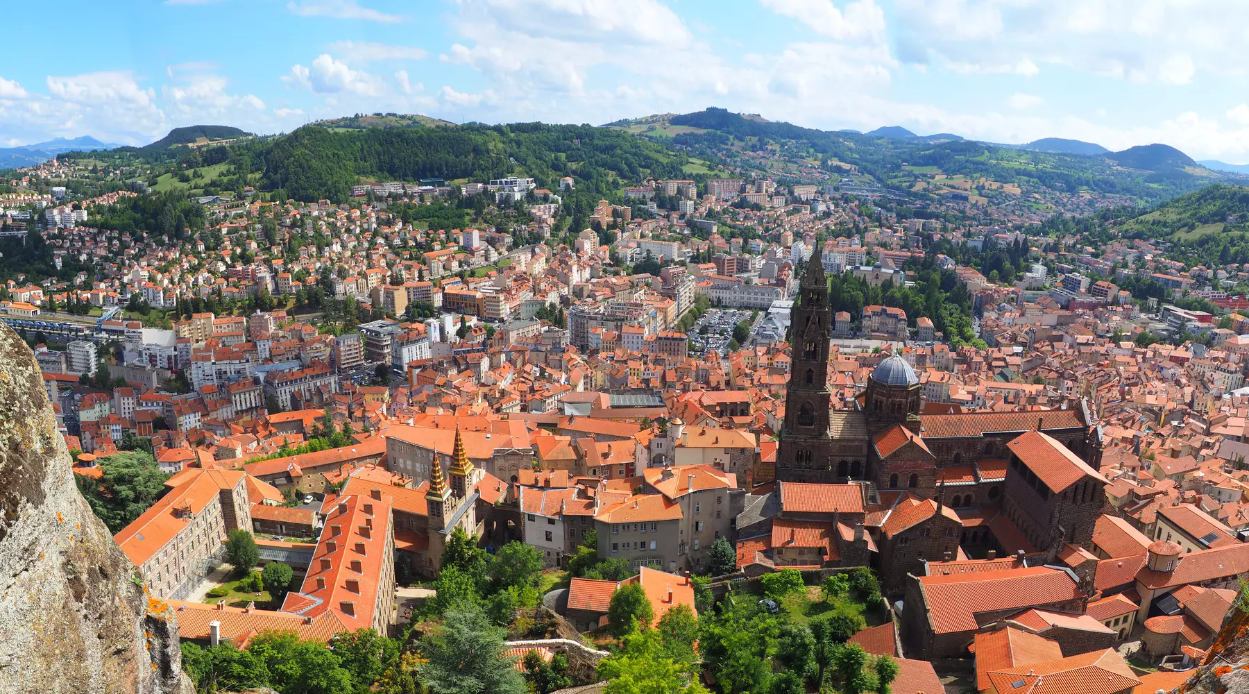
LE PUY EN VELAY
Arrive at the hotel at the end of the afternoon and overnight stay.
Altitude: 625m
DAY
2
LE PUY EN VELAY - ST. PRIVAT D'ALLIER 23.5km
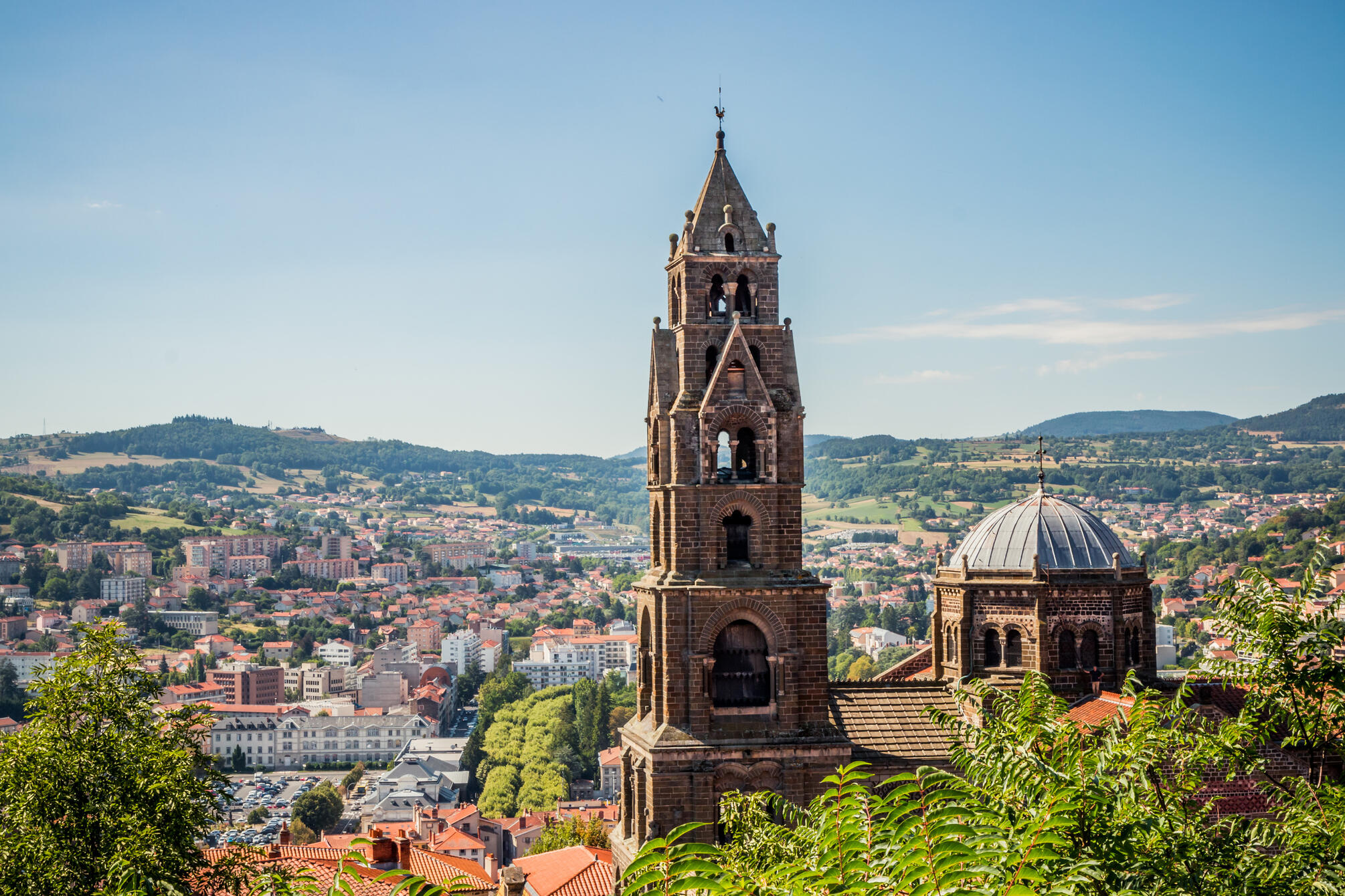
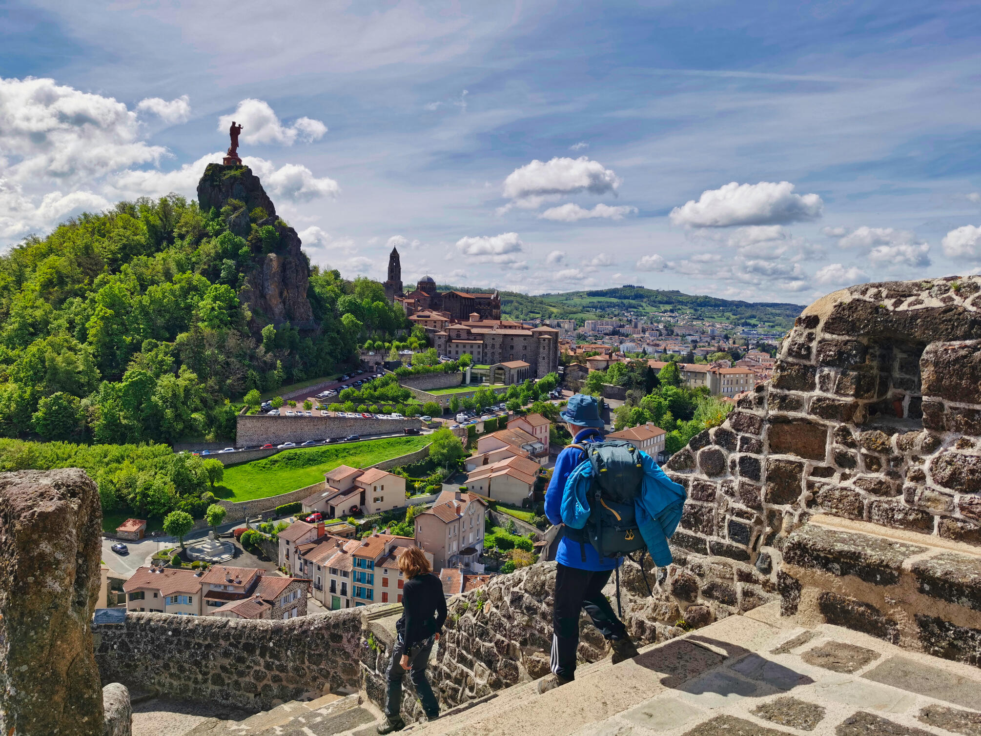
From the hotel on the outskirts of Le Puy en Velay, you'll have time to walk through part of the old town, and why not extend your walk a little by taking the grand staircases leading up to the cathedral (dating from the 11th and 12th centuries). Leaving Le Puy, there is a magnificent panoramic view over the entire basin. Then on through the Velay region (home of the lentil and the black ewe), passing through La Roche, St Christophe sur Dolaizon, Montbonnet and then St Privat d'Allier.
Altitude: 890m
- Elevation: D+ 660m / D- 460m
- Duration: 5h-6h
DAY
3
ST. PRIVAT D'ALLIER - SAUGUES 19km
Between these two stage, you will cross very different landscapes and terrain, from the small stony path that passes through Rochegude (an interesting lookout point overlooking a gap in the Allier), to the passage through the gorges at Monistrol (a superb climb above the Allier passing the chapelle de la Madeleine, a 17th-century "cave chapel"), before finally approaching the Margeride plateau before Saugues.
Altitude: 960m
- Elevation: D+ 660 m / D- 560m
- Duration: 4h-5h
DAY
4
SAUGUES - LES FAUX 29km
A stage to discover the Margeride plateau, with its typical villages, lost hamlets, crosses and pastures surrounded by stone walls. Each village has its own charm (granite houses with carved door pediments, gardens, etc.): Le Pinet, La Clauze (with its curiously leaning tower!), le Falzet, la ferme du Contaldès, le domaine du Sauvage, la chapelle St Roch, then off the GR (1 Km), you'll reach the village of Les Faux.
Altitude: 1113m
- Elevation: D+ 570 m / D- 360m
- Duration: 7h-8h
DAY
5
LES FAUX - AUMONT AUBRAC 21km
This stage continues across the Margeride plateau to Aumont, the gateway to Aubrac. Between Le Rouget, St Alban and Les Estrets, you'll still come across pretty hamlets and churches with a combed bell tower (a wall bell tower supporting another small bell tower).
Altitude: 1050m
- Elevation: D+ 400m /D - 500m
- Duration: 5h-6h
DAY
6
AUMONT AUBRAC - NASBINALS 26km
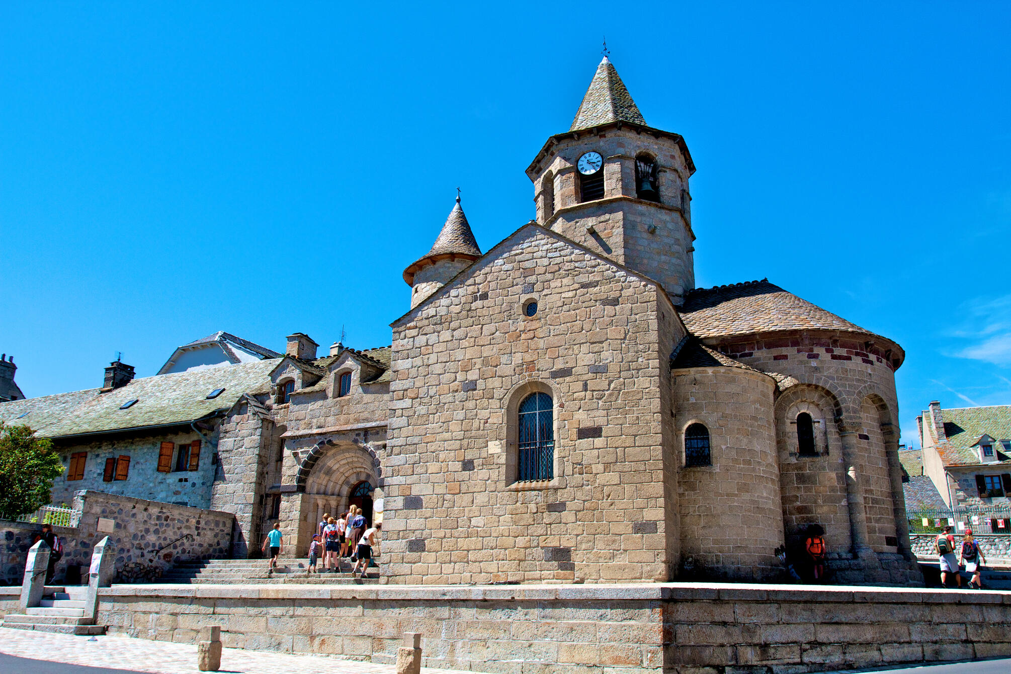
A slightly long stage, but without difficulty. We leave the Margeride to cross the Plateau de l'Aubrac (a large plateau with pastures, burons, dry stone walls and, depending on the season, flowerbeds); we pass through La Chaze de Peyre, Lasbros, Rieutort d'Aubrac and Montgros before arriving at Nasbinals (a superb 14th-century Romanesque church built of brown basalt).
Altitude: 1180m
- Elevation: D+ 400m / D- 260m
- Duration: 7h-8h
DAY
7
NASBINALS - ST. CHELY D'AUBRAC 17 km
This stage descends to the Boraldes valley. We pass through the village of Aubrac, a historic centre on the Plateau at an altitude of 1,300m, where we can see the Church of Notre Dame des Pauvres and the remains of the Dômerie. We then descend to Belvezet to reach St Chély d'Aubrac.
Altitude: 808m
- Elevation: D+ 220m / D- 580m
- Duration: 4h-5h
DAY
8
ST CHELY D'AUBRAC - ST COME D'OLT 16 km
We leave Saint Chély d'Aubrac via the old bridge over La Borlade. We are in the Lot valley. After crossing part of the Rouergue region, we reach the town of St Côme d'Olt, listed as one of the most beautiful villages in France.
Altitude: 385m
- Elevation: D+ 250m / D- 700m
- Duration: 4h-5h
DAY
9
ST COME D'OLT - ESTAING 20.5 km
Our route follows the course of the River Lot. On this stage, we pass through Espalion, then St Pierre de Bessuéjol before arriving at the village of Estaing, also classified as one of the most beautiful in France.
Altitude: 320m
- Elevation: D+ 410m / D- 460m
- Duration: 4h-5h
DAY
10
ESTAING - GOLINHAC 16 km
This is a stage with some changes in altitude: the ascent to Golinhac is a little tough as it is on tarmac. The village is home to a great deal of St James' heritage: church, stone cross sculpted with a small pilgrim holding a bumblebee: this village was on a pilgrimage route as early as the 11th century.
Altitude: 630m
- Elevation: D+ 540m / D- 220m
- Duration: 4h-5h
DAY
11
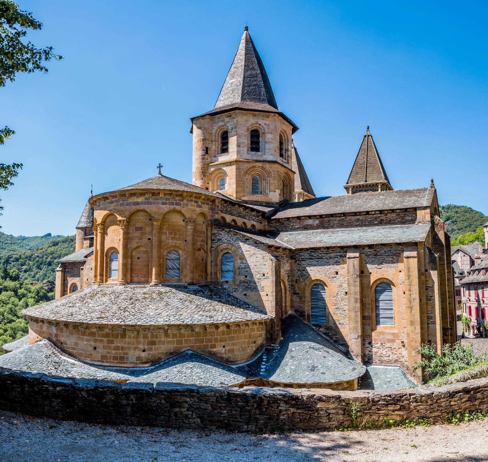
GOLINHAC - CONQUES 21 km
After the start, there's a fairly steep climb here too (difference in altitude 220m), before descending to Conques, listed as one of the most beautiful villages in France. You'll have plenty of time to explore this medieval village and its many treasures, including the abbey church and its Romanesque sculptures.
Altitude: 280m
- Elevation: D+ 360m / D- 700m
- Duration: 7h
DAY
12
CONQUES
End of stay after breakfast.
Altitude: 625m
Map

Organization
Access
SNCF railway of the Puy en Velay.
The price covers
- 11 nights in Half-board
- Luggage transfer between each stage of the walk
- Provision of 1 guidebook
- Tourist tax
- Luggage transfer between each stage of the walk
- Provision of 1 guidebook
- Tourist tax
The price does not cover
- Insurance
- Drinks and personal expenses
- Transfers from your home to the meeting point and dispersal
- Picnic lunch
- Return shuttle
- Application fees and postage abroad
- Drinks and personal expenses
- Transfers from your home to the meeting point and dispersal
- Picnic lunch
- Return shuttle
- Application fees and postage abroad
Accommodation
1*, 2** and 3*** hotels or guest rooms.
Date and price
| Arrival dates | Price pp | Booking |
|---|---|---|
| 01/04/2026 to 30/10/2026 | 1320 € | Booking |