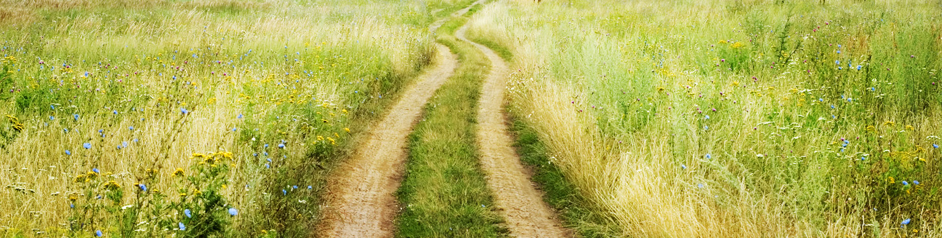
The Le Puy Way, or Via Podiensis, is the most celebrated pilgrimage route across France to Santiago de Compostela. Following the GR 65 for approximately 750 kilometres from Le Puy-en-Velay to Saint-Jean-Pied-de-Port, this trail crosses some of the most beautiful and varied landscapes in France: the volcanic plateaux of the Velay, the wild gorges of the Allier, the windswept highlands of the Aubrac, the limestone causses of the Quercy, the rolling farmland of Gascony, and the green foothills of the Pyrenees. Listed as a UNESCO World Heritage Site, the Le Puy Camino is a true journey through French history, culture and countryside.
Key features of the Le Puy Way
- Official name: Via Podiensis / Chemin du Puy
- Trail marking: GR 65
- Total distance: approximately 750 km
- Number of stages: 36
- Number of sections: 6 (plus 2 alternative routes)
- Recommended season: spring, summer and autumn (April to October)
- Difficulty: Level 2 (on average 5 hours of walking per day on paths and tracks through rolling terrain, with no more than 600 m of cumulative elevation gain per stage)
- Main sections: Le Puy-en-Velay to Nasbinals / Nasbinals to Conques / Conques to Cahors / Cahors to Lectoure / Lectoure to Aire-sur-l'Adour / Aire-sur-l'Adour to Saint-Jean-Pied-de-Port
- Recommended starting section: Le Puy-en-Velay to Nasbinals (5 stages, 7 days)
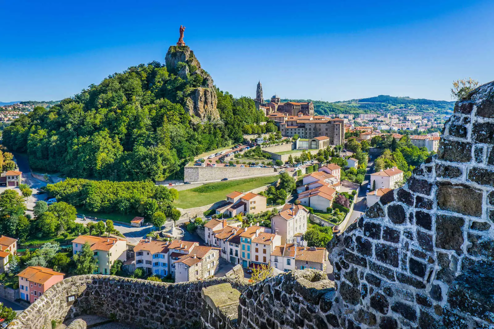
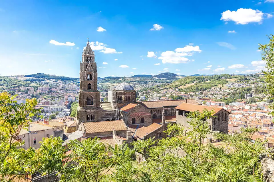
- Key points of interest: Le Puy-en-Velay (Notre-Dame Cathedral, Rocher Saint-Michel d'Aiguilhe, pilgrims' blessing), the Domaine du Sauvage, the Aubrac plateau, Conques (Abbey Church of Sainte-Foy, one of the finest Romanesque churches in France), Figeac (medieval streets), Cahors (Pont Valentré), Moissac (Romanesque cloister, UNESCO), and Saint-Jean-Pied-de-Port (Porte Saint-Jacques, gateway to Spain)
- Regions crossed: Haute-Loire, Lozère, Aveyron, Lot, Tarn-et-Garonne, Gers, Pyrénées-Atlantiques
- Alternative routes: Célé Valley variant (GR 651) and Rocamadour variant (GR 652)
Overview of the Le Puy Way route
The Via Podiensis is widely considered the finest long-distance walking route in France. From Le Puy-en-Velay and its extraordinary cathedral, the trail heads south through the volcanic highlands of the Velay and the remote Margeride before reaching the vast, open landscape of the Aubrac. Beyond the Aubrac, the route descends into the Lot valley and the medieval village of Conques, home to one of the great treasures of Romanesque art.
From Conques, the trail continues through Figeac and the limestone causses of the Quercy to Cahors and its iconic Pont Valentré. Between Figeac and Cahors, walkers can choose between the main route, the scenic Célé Valley variant (GR 651) with its cliff paths and troglodyte villages, or the Rocamadour variant (GR 652) passing through one of the most visited pilgrimage sites in Europe.
Beyond Cahors, the route crosses the gentle hills of Gascony through Lectoure, Condom and Aire-sur-l'Adour, before entering the Basque Country for the final stages to Saint-Jean-Pied-de-Port, the traditional starting point of the Camino Francés into Spain.
Le Puy Way stages
Le Puy-en-Velay to Nasbinals
The opening section of the Le Puy Way takes you from the dramatic volcanic landscape of Le Puy-en-Velay through the remote Margeride hills to the Aubrac plateau. The departure from the cathedral in Le Puy, with the traditional pilgrims' blessing, is one of the most memorable moments on any Camino. You pass through the wild Allier gorges, cross the Domaine du Sauvage (a vast, isolated upland estate) and reach Nasbinals on the edge of the Aubrac.
| From | To | Distance |
|---|---|---|
| Le Puy-en-Velay | Saint-Privat | 23.5 km |
| Saint-Privat | Saugues | 19 km |
| Saugues | Les Faux (or Lajo) | 27 km or 26 km |
| Les Faux (or Lajo) | Aumont-Aubrac | 21 or 23 km |
| Aumont-Aubrac | Nasbinals | 26 km |
Total Distance : 116,5 km
For tailor-made stages: Montbonnet, Monistrol-d'Allier, La Clauze, Le Villeret-d'Apchier, Le Sauvage, Saint-Alban-sur-Limagnole, Bigose, Finieyrols, Montgros.
Nasbinals to Conques
This section crosses the Aubrac plateau, one of the most iconic landscapes on the Le Puy Way: vast open pastures, stone walls, granite crosses and traditional burons (stone shepherds' huts). The trail then descends through the Lot valley, passing the beautiful villages of Espalion and Estaing (both listed among the Most Beautiful Villages of France), before reaching Conques and its magnificent Abbey Church of Sainte-Foy.
| From | To | Distance |
|---|---|---|
| Nasbinals | Saint-Chély-d'Aubrac | 16.5 km |
| Saint-Chély-d'Aubrac | Saint-Côme-d'Olt | 16.5 km |
| Saint-Côme-d'Olt | Estaing | 20.5 km |
| Estaing | Golinhac | 14.5 km |
| Golinhac | Conques | 21 km |
Total Distance : 89 km
For tailor-made stages: Aubrac, Espalion, Fonteilles, Massip, Bessoles, Espeyrac, Sénergues.
Conques to Cahors
From Conques, the trail follows the Lot valley through Figeac, a lively medieval town, before climbing onto the limestone causses of the Quercy. The landscape becomes drier and more Mediterranean in character, with white stone paths, truffle oaks and walnut groves. The section ends at Cahors, where the famous Pont Valentré spans the river Lot.
| From | To | Distance |
|---|---|---|
| Conques | Livinhac-le-Haut (or Decazeville) | 24 km (or 20 km) |
| Livinhac-le-Haut (or Decazeville) | Figeac | 26 km (or 29 km) |
| Figeac | Cajarc | 30 km |
| Cajarc | Limogne-en-Quercy | 18 km |
| Limogne-en-Quercy | Lalbenque | 21.5 km |
| Lalbenque | Cahors | 18 km |
Total Distance : 137,5 km
For tailor-made stages: Montredon, Felzins, Béduer, Gréalou, Ussac, Bach, Vaylats.
Figeac to Cahors: Célé Valley variant (GR 651)
The Célé Valley variant is one of the most scenic alternative routes on any Camino. The trail follows the river Célé through a narrow limestone valley, past cliff-face paths, troglodyte villages and Romanesque chapels. The village of Saint-Cirq-Lapopie, perched above the Lot, is regularly voted one of the most beautiful villages in France. This variant rejoins the main route at Cahors.
| From | To | Distance |
|---|---|---|
| Figeac | Espagnac-Sainte-Eulalie | 23 km |
| Espagnac-Sainte-Eulalie | Marcilhac-sur-Célé | 18 km |
| Marcilhac-sur-Célé | Cabrerets | 19 km |
| Cabrerets | Saint-Cirq-Lapopie | 11 km |
| Saint-Cirq-Lapopie | Vers | 23 km |
| Vers | Cahors | 20 km |
Total Distance : 114 km
Figeac to Cahors: Rocamadour variant (GR 652)
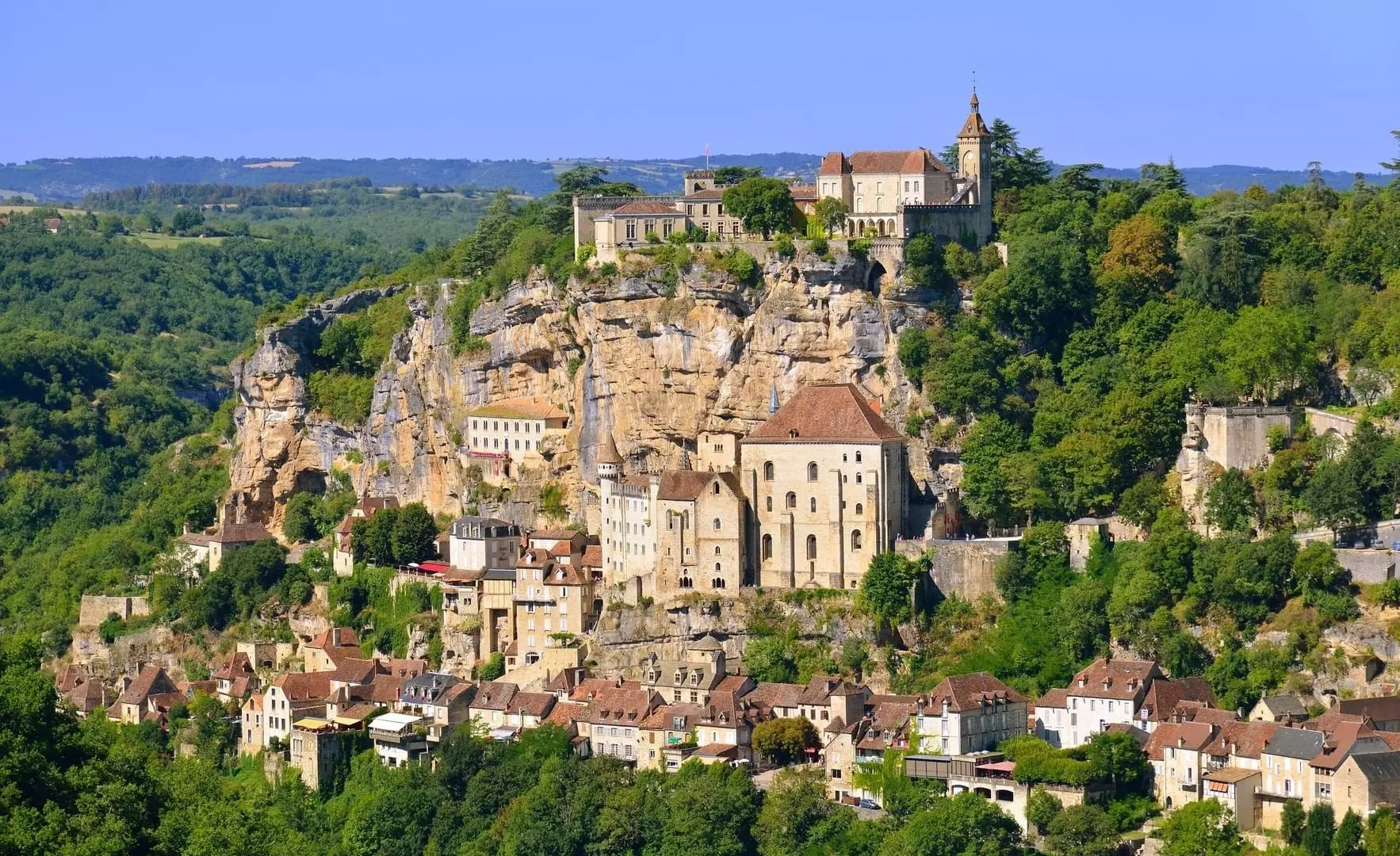
The Rocamadour variant takes a more northerly route through the Quercy countryside, passing through Gramat before reaching Rocamadour, one of the most visited pilgrimage sites in France. The sanctuary, built into the cliff face above the Alzou gorge, has drawn pilgrims for centuries. The variant rejoins the main route at Cahors via Labastide-Murat and Vers.
| From | To | Distance |
|---|---|---|
| Figeac | Lacapelle-Marival | 23 km |
| Lacapelle-Marival | Gramat | 23 km |
| Gramat | Rocamadour | 14 km |
| Rocamadour | Labastide-Murat | 26 km |
| Labastide-Murat | Vers | 27 km |
| Vers | Cahors | 21 km |
Distance Totale : 134 km
Cahors to Lectoure
From Cahors, the trail crosses the rolling hills of the Quercy Blanc before reaching Moissac, home to one of the finest Romanesque cloisters in Europe (UNESCO World Heritage). Beyond Moissac, the landscape shifts to the gentle farmland of the Gers, with sunflower fields, plum orchards and quiet villages. The section ends at Lectoure, a handsome hilltop town with views across the Gascon countryside.
| From | To | Distance |
|---|---|---|
| Cahors | Lascabanes | 25 km |
| Lascabanes | Lauzerte | 23 km |
| Lauzerte | Moissac | 27.5 km |
| Moissac | Auvillar | 21 km |
| Auvillar | Flamarens (or Miradoux) | 15 km (or 19 km) |
| Flamarens (or Miradoux) | Lectoure | 20 km (or 16 km) |
Total Distance : 131,5 km
For tailor-made stages: Montcuq, Durfort-Lacapelette, Saint-Antoine.
Lectoure to Aire-sur-l'Adour
The trail now crosses the heart of Gascony, through Condom and Eauze (the ancient capital of Armagnac) to Nogaro and Aire-sur-l'Adour. This is a quintessentially French section: quiet lanes through vineyards, Armagnac distilleries, fortified villages and open countryside dotted with sunflowers and maize. The walking is gentle and the hospitality generous.
| From | To | Distance |
|---|---|---|
| Lectoure | La Romieu | 19 km |
| La Romieu | Condom | 16 km |
| Condom | Montréal-du-Gers | 17 km |
| Montréal-du-Gers | Eauze | 16 km |
| Eauze | Nogaro | 20 km |
| Nogaro | Aire-sur-l'Adour | 27 km |
Total Distance : 115 km
For tailor-made stages: Marsolan, Castelnau-sur-l'Auvignon, Larressingle, Manciet, Haget, Lanne-Soubiran, Barcelonne-du-Gers.
Aire-sur-l'Adour to Saint-Jean-Pied-de-Port
The final section of the Le Puy Way takes you through the Béarn countryside and into the Basque Country. The trail passes through Navarrenx, one of the oldest fortified towns in France, and the Basque villages of Saint-Palais and Ostabat before reaching Saint-Jean-Pied-de-Port, the gateway to Spain. The arrival through the Porte Saint-Jacques, with the medieval citadel above, marks the end of the French route and the beginning of the Camino Francés across the Pyrenees.
| From | To | Distance |
|---|---|---|
| Aire-sur-l'Adour | Miramont-Sensacq | 18 km |
| Miramont-Sensacq | Larreule | 27 km |
| Larreule | Maslacq | 27.5 km |
| Maslacq | Navarrenx | 22.5 km |
| Navarrenx | Aroue | 24 km |
| Aroue | Saint-Palais | 17 km |
| Saint-Palais | Larceveau | 17 km |
| Larceveau | Saint-Jean-Pied-de-Port | 19 km |
Total Distance : 172 km
For tailor-made stages: Arzacq-Arraziguet, Arthez-de-Béarn, Argagnon, Sauvelade, Lichos, Amaren Bidea, Ostabat.
Tips for planning your walk on the Le Puy Way
Best time to go
You can walk the Le Puy Way on any date you choose between April and October. Here are a few seasonal tips:
- In spring (April and May), the landscapes are green and the trail is peaceful. June is one of the finest months: long days, pleasant temperatures and vibrant countryside.
- In summer (July and August), the atmosphere on the trail is lively, but early starts are recommended to avoid the heat, particularly on the causses.
- In autumn (September and October), the trail takes on golden autumnal tones and the walking is quieter. September is especially recommended.
The most challenging stages
- Saint-Privat to Saugues (19 km): a technical descent into the Allier gorges at Monistrol, followed by a steep climb onto the Margeride plateau.
- Aumont-Aubrac to Nasbinals (26 km): the Aubrac plateau is windswept and exposed, with few sheltered spots.
- Conques to Livinhac-le-Haut (24 km): a demanding climb out of Conques with significant elevation gain.
- Figeac to Cajarc (30 km): one of the longest stages on the route.
- Célé Valley variant, especially Espagnac to Marcilhac and Marcilhac to Cabrerets: narrow paths and steep climbs along the cliff face.
Our favourite stages
- Le Puy-en-Velay to Saint-Privat: a magical departure from the cathedral at Le Puy, with panoramic views over the volcanic landscape of the Velay.
- Nasbinals to Saint-Chély-d'Aubrac: the crossing of the Aubrac plateau, with its vast open horizons, stone walls and burons.
- Conques to Figeac: Conques is one of the most beautiful villages in France, and the stage out of the valley is unforgettable.
- The Célé Valley variant: spectacular cliff-top paths above the river, troglodyte villages and the arrival at Saint-Cirq-Lapopie.
- Larceveau to Saint-Jean-Pied-de-Port: the final stage through the Basque Country, with its white timber-framed houses, before the arrival at Saint-Jean-Pied-de-Port where the French route ends and the Spanish Camino begins.
En parcourant le chemin du Puy, vous vivez une aventure unique mêlant nature, patrimoine et rencontres humaines. Mais pour profiter pleinement de chaque étape, mieux vaut être bien accompagné ! La Pèlerine est à votre disposition pour répondre à toutes vos questions et organiser votre séjour sur mesure. En choisissant une agence spécialisée, vous bénéficiez d’un hébergement réservé, du transport de vos bagages, d’un itinéraire sécurisé et d’une logistique sans stress pour ne garder que l’essentiel : le plaisir de marcher et de découvrir.
With Walks in France, your accommodation is booked in advance, your luggage is transferred between each stage, and you receive a detailed route book with maps and directions. We organise self-guided walking holidays on every section of the Le Puy Way, including the Célé Valley and Rocamadour variants. We can create a tailor-made itinerary adapted to your pace and schedule. Whether you walk the full 750 kilometres or just one section, we handle the logistics so you can focus on the trail.
Our agency is based in Le Puy-en-Velay, at the very start of the route, and we have been welcoming pilgrims since 1988. We know every stage, every village and every guesthouse on this trail.
From Saint-Jean-Pied-de-Port, you can continue on the Camino Francés into Spain, or explore the Basque Way to Hendaye. You can also view the full map of all Camino de Santiago routes.
Why choose Walks in France ?
Specialist in compostela stays
35 years of experience
An human-scale agency
No baggage to wear
Quality accomodation
Taylor-made stays